 111
111 2
2 3
3 45
45 6789
6789 10
10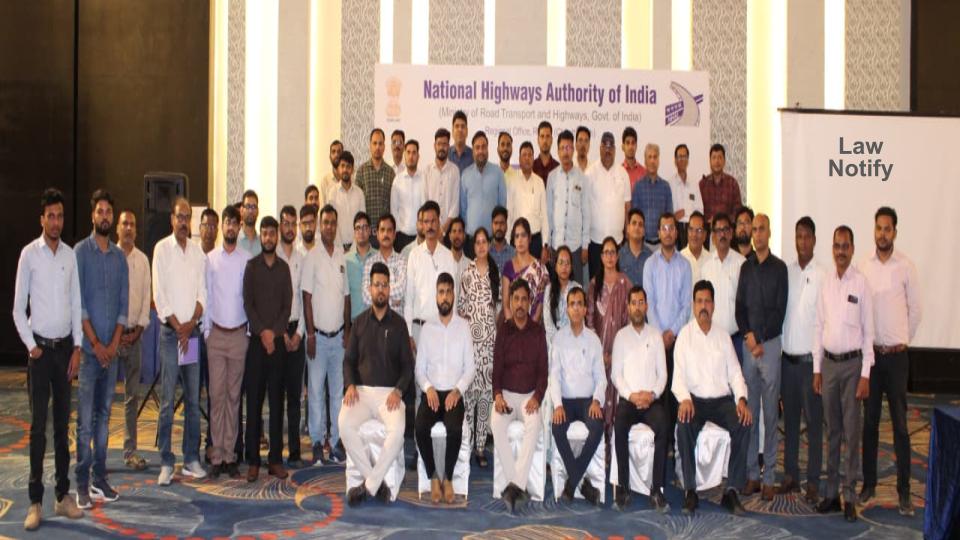
Raipur : In a move to modernise highway development, the National Highways Authority of India (NHAI), in collaboration with the Survey of India, held a one-day workshop on precision positioning using the Continuously Operating Reference Stations (CORS) network.
The session focused on improving the planning, surveying and execution of national highway projects by shifting from conventional Global Positioning System (GPS) methods to more advanced, real-time geospatial technologies. Officials highlighted that CORS-based positioning can deliver highly accurate data, addressing long-standing limitations of traditional GPS systems and improving efficiency and transparency in infrastructure projects.
Speaking at the event, NHAI Regional Officer Pradeep Kumar Lal said that adopting CORS technology would mark a transition toward smarter and more modern highway construction. He noted that access to real-time, high-precision data would enable engineers and contractors to execute projects with greater accuracy while aligning with global standards.
During the technical session, Superintendent Surveyor Rajesh Ranjan explained that the CORS network offers a robust geospatial framework capable of providing reliable positioning services across varied terrains. He added that its application in highway development would support error-free digital mapping and dependable data collection.
Surveyor Prabhat Kumar Pradhan emphasised that CORS enables centimetre-level accuracy in surveying and construction activities. He said the technology allows real-time monitoring, improves construction quality and helps reduce both time and project costs.
The workshop was attended by officials including Project Director D.D. Parlawar, Digvijay Singh, Mukesh Kumar and Executive Engineer Ramveer Yadav from the Ministry of Road Transport and Highways, along with other technical staff.